
English| USD
Suggested for you
More currencies
Choose a language
The route sounds fixed until the boat leaves the harbour and the skipper reorders the day. This Tour B El Nido Map guide sets out the five standard stops, how they sit relative to one another in Bacuit Bay, and which of them the tide controls. It also explains why the printed sequence is only ever a suggestion.
Quick answer
Tour B maps as a single loop of five stops north-east of El Nido Port: the Snake Island sandbar, Pinagbuyutan Island, Entalula Beach, Cudugnon Cave and Cathedral Cave. Boats work the bay daily, 07:00–17:00, and an 08:00–09:00 start is advised because Cudugnon's low entrance only clears at the right tide. The order shifts with wind and swell, not with the leaflet.
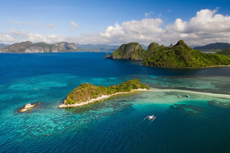
Snake Island is not, strictly speaking, an island. The landmark that anchors almost every Tour B El Nido Map is a sandbar: a curving spit of white sand that surfaces in Bacuit Bay as the tide falls and disappears when it returns. Its formal name is Vigan Island. That one detail explains why no two printed route cards agree, and why the circuit is better understood as a set of points than as a line. The circuit works the water east and north-east of town, out where limestone karst towers rise straight from the shallows. Five stops are standard. The sandbar and its short ridge viewpoint. Pinagbuyutan Island, the solitary tower visible from the town beach. Entalula Beach, a sheltered cove used as the midday stop. Cudugnon Cave, entered through a low crawl-in mouth and known to archaeologists for the burial-jar fragments recovered from its chamber. And Cathedral Cave, read from the water rather than walked into. Boatmen order these stops by wind, not by the sequence on any leaflet. The amihan, the north-east monsoon that settles over Palawan late in the year, pushes swell onto the outer faces; the habagat reverses the pattern in the wet months. An El Nido island hopping route that opens at Pinagbuyutan one morning may close there the next. Reading the chart therefore means reading water. Distances between stops are short, most lying within an hour of one another aboard an outrigger bangka, so the variable is not travel time but access. Tide decides whether Cudugnon's entrance is a step or a swim. Swell decides whether the boat can hold position beneath Cathedral Cave. Wind decides whether the sandbar is a beach or a shoal under half a metre of water. Snorkelling conditions shift with the same three factors, which is why guides keep the day's order provisional until the bangka clears the headland. The practical use of a Tour B El Nido Map, then, is annotation rather than navigation. Mark the five points. Note beside each which one depends on tide, which one is a viewing stop, and which one offers shade at midday. Travellers weighing this El Nido boat tour route against the lagoons of the neighbouring circuit will find the difference is exposure: Tour B sits further out in open water, with longer crossings and wider views of the Bacuit karst. Hours, fees, timings and the packing list sit in the dedicated sections below; the departures themselves are handled on the booking pages.
“The geography of this circuit is tidal, and so is its sequence.”
This plan suits first-time visitors joining a standard full-day Tour B boat trip from El Nido Port, covering five classic stops across roughly seven to eight hours on the water. Timings shift by an hour or so depending on tide and how your boat crew sequences the route.
Groups gather at the port, split across bangkas, and the crew runs through snorkel gear and life jackets. Expect 20 to 30 minutes of queueing and transfer before the boat pulls away.
A 30 to 40 minute stop on the shifting sandbar linking Vigan Island to the mainland, with a short uphill trail to the viewpoint. The sandbar is widest at low tide, so the walk can be shorter when water is high.
A 20 to 25 minute stop with a crouch-and-duck entry through a low rock opening into the chamber. Tide level dictates how easy the entry is, and the crew will time it accordingly.
The boat slows alongside the tall limestone opening for 10 to 15 minutes. You stay aboard here, as entry is not permitted, so keep a camera handy.
The crew grills lunch on the beach while you swim and rest for 60 to 75 minutes. Shade is limited, so claim a spot under the tree line early.
A 45 to 60 minute reef stop with shallow coral close to shore. Currents can pick up in the afternoon, so stay within the crew's marked area.
The boat heads back across Bacuit Bay in 45 to 60 minutes depending on swell. Afternoon winds make the ride bumpier than the morning leg, so stow dry bags before departure.
The best arrival window for Tour B is 08:00–09:00. This timing allows you to avoid peak crowds and ensures optimal tide levels for accessing cave destinations on the route.
Warm and sunny, 26°C–32°C
Clear skies provide calm waters for easier boat travel and cave access.
Humid with rain showers, 25°C–31°C
Increased chance of tours being rescheduled due to inclement weather and sea conditions.
—
Visiting on weekdays helps you avoid weekend influxes and secures priority entry to popular stops.
Verdict: The best time to visit is during the dry season from December to May, specifically arriving between 08:00–09:00 on a weekday.
All island hopping activities, including Tour B, depart from the El Nido Port located in El Nido, Palawan. Most visitors arrive at the port on foot if staying in the town proper or via tricycle from nearby accommodations.
Walking to El Nido Port via Serena Street
Tricycle to El Nido Port
Private transfer to El Nido Port
Plan to arrive at the port between 08:00 and 09:00 to avoid peak crowds and ensure you catch optimal tide levels for cave entry.
Tour B operations at the El Nido port maintain consistent daily hours throughout the week. Tours depart from the port area according to the schedule listed below.
Tour B covers cave and lagoon stops, so a few bookings and items need sorting before you reach El Nido Port.
Everything you need to know about tour b el nido map
A typical layout for an El Nido boat expedition guide highlights stops such as Snake Island, Pinagbuyutan Island, and various limestone caves. Reviewing a tour b el nido map helps travelers visualize the geographical flow between these protected marine sanctuaries. You will often find that the route focuses on coastal landmarks and distinct rock formations across the Bacuit Archipelago. Understanding the sequence of stops on the tour b el nido map assists in managing expectations for boat travel times between destinations. The best arrival window at the port is 08:00–09:00 to avoid peak crowds and ensure optimal tide levels for cave entry. Visitors are required to pay a 200 PHP Eco-Tourism Development Fee, which is valid for 10 days of exploration in the area. Consulting a local El Nido island hopping itinerary ensures you have a clear plan for water activities like snorkeling and cave exploration while respecting the marine protected area regulations.